|
Waterrow |
Waterrow is a
pretty little hamlet on the Taunton to Barnstable road on the southern
edge of the Brendon hills in the parish of Chipstable, and lies about a
mile south of that village.It was known for many centuries as East and
West Skirdal until the early 20th century. From the latter half of the
18th century, the name Waterrue, then Waterrow crept in, and for over a
century both old and new names were in use.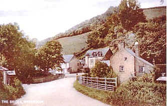
The original name is taken from the Old Norse "Skir", meaning clear, bright, pure, referring to the river and the Saxon "Dael", a valley. The old name of the hamlet lives on in the names of two houses locally, Skirdale and East Skirdale.
Just in the south
stand the pillars of the Brunel built viaduct which carried the Taunton
to Barnstable railway from 1873, when it was built to carry broad gauge
track,(it was converted to standard gauge in 1881), until it's closure
by Beeching in 1966. The fields on the surrounding hills suggest a Saxon
layout, and there are traces of both Iron age and Celtic occupation.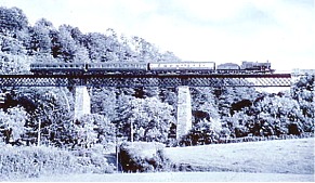
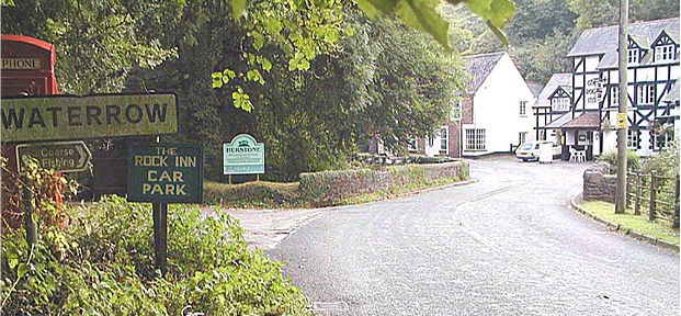
Some of Waterrow houses are thatched, as was the building which was to become The Rock Inn, it was one of three Smithys which stood by the banks of the River Tone amidst a number of shops and workshops clustered around Bibails bridge, it became The Rock House Inn around 1850, when the building was some 300 years old and became a Coaching Inn.
During the 1920's it was refurbished and refashioned with further internal changes in the 1970's more changes were made in the 1990's with the welcome addition of the proprietors flat a pool room and extensive modernisation of the kitchen and store making it the attractive building it is today.
The Rock Inn is
built against the rock face, part of which is exposed in the bar. Until
quite recent times, the inn had two spectral residents from the past---a
young girl, of whom little is known, and an ex landlady who hanged
herself on the premises, it must be said however that neither of these
residents have been heard of for a good many years. opposite the inn
stands a 300 year old cottage "pinkwood", which was The
Travellers Rest Inn from 1819 until about 1851.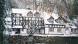
Alongside these buildings a Toll-House stood in the days of Turnpike Roads, and a Mill stood behind the Travellers Rest until about 1840, these and the shops and workshops have long since gone. A second Mill, Manor Mill, still exists in name only a little further up the valley which today offers self catering accomodation. The road we use today did not exist before 1824, when the section from Wiveliscombe towards Petton Cross was built, and a new Toll-House was built for this new Turnpike road, the site of which is now across the bridge being one of the Rock Inn's car parks.
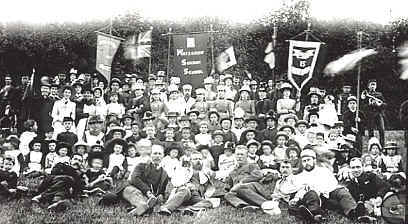
In the 19th
century, Waterrow was bigger than it's neighbour Chipstable, and most of
the inhabitants of the parish lived in the lower lands around Waterrow.
A Church Hall was built in 1908 for services and social events to avoid
the mile and a half climb to the church at Chipstable. Both the Church
of England and the Congregationalists held 'Cottage Meetings' in the
'Hall' until the building of the 'Bethel Chapel (since closed) in 1890.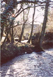
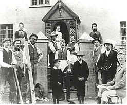
During the 17th century there lived in Waterrow a 'Conjuror' or white witch by the name of Burge. Also living here from 1874-1957 was Alfred Pool, inventor and professional photographer. Amongst his early inventions were a telephone, a calf feeder a steam car and a petrol driven car. When he died there was nobody to carry on the buisiness. His machinery was sold for scrap, what wasn't metal was burnt on a bonfire which burnt for four days.
The area around Waterrow abounds in footpaths which are a delight for the casual walker. A new path has been opened south east of the Rock Inn called 'The Squash,' following where possible the course of the River Tone towards the Viaduct Piers and continuing past the old Iron Age fort and villiage of Hagley.
A large Waterrow gathering Cardiff cottages