
Waterrow
Chipstable Raddington
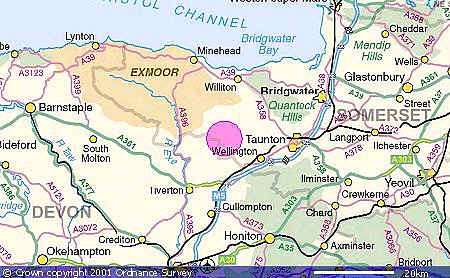
.AREA MAP - (detailed location map below)
Leave the M5 at Junction 25 (Taunton).
Follow the A358 (signposted to
Minehead) around Taunton, and then turn left onto the B3227 (signposted
Wiveliscombe).
At Wiveliscombe follow the road ahead at the traffic lights,
and Waterrow, Chipstable and Raddington are about 3 miles further on.
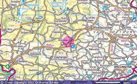
Image produced from the Ordnance Survey Get-a-map
service.
Image reproduced with kind permission of Ordnance Survey and